Computational modeling of failures involving chemical substances
Our service focuses on the quantitative and spatial assessment of accident consequences involving chemically pure hazardous substances. We specialize in hazard analysis for materials classified as class 2 (gases), class 3 (flammable liquids), class 6.1 (toxic substances), and class 8 (corrosive materials). We place particular emphasis on High Consequence Dangerous Goods (HCDG) - substances whose release or misuse can result in mass casualties, infrastructure destruction, or socio-economic disruption.
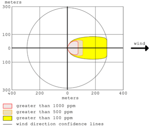
In our analytical process, we utilize certified dispersion modeling software (EPA/NOAA), which we strictly integrate with Geographic Information Systems (GIS) and satellite mapping systems. Each simulation incorporates site-specific meteorological data (wind, temperature, atmospheric stability class) and local environmental characteristics.
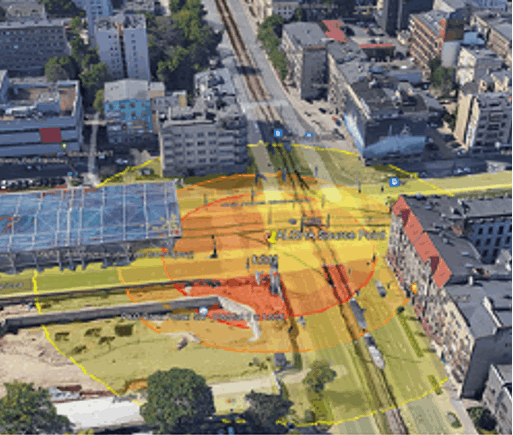
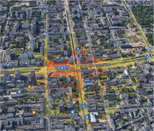
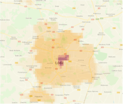
To ensure the highest precision, we overlay hazard plumes onto specialized demographic layers based on open-source satellite datasets. This allows for a realistic assessment of risk to the local population.
The results of our analyses serve as the technical foundation for key safety procedures within your enterprise:
- route optimization - defining transport corridors that minimize the risk of infrastructural and social crises;
- infrastructure planning - verification of locations for critical logistical operations (filling, emptying zones, and warehouse management);
- crisis response - precise determination of evacuation zone boundaries for various accident scenarios.
We thus provide a multi-dimensional and reliable risk assessment that translates into informed management decisions - eliminating the element of "flying blind" during emergency planning.